
TORNADO WARNING
(10 counties)Clarke, Decatur, Ringgold, Union
Until 8:45 PM Friday
Until 8:45 PM Friday
More Information
At 805 PM CDT, a severe thunderstorm capable of producing a tornado was located over Beaconsfield, or 12 miles northeast of Mount Ayr, moving northeast at 40 mph. HAZARD...Tornado and three inch hail. SOURCE...Radar indicated rotation. At 803 pm the Mount Ayr Cooperative Observer reported 3 inch diameter hail in the city. IMPACT...Flying debris will be dangerous to those caught without shelter. Mobile homes will be damaged or destroyed. Damage to roofs, windows, and vehicles will occur. Tree damage is likely. This dangerous storm will be near... Sun Valley Lake and Grand River around 810 PM CDT. Osceola around 825 PM CDT. Lakeside Casino around 830 PM CDT. Other locations impacted by this tornadic thunderstorm include Grand River, Ellston, Murray Roadside Rest Area, Beaconsfield, Woodburn, and Murray. This includes Interstate 35 between mile markers 25 and 41.
TAKE COVER NOW! Move to a basement or an interior room on the lowest floor of a sturdy building. Avoid windows. If you are outdoors, in a mobile home, or in a vehicle, move to the closest substantial shelter and protect yourself from flying debris. Tornadoes are extremely difficult to see and confirm at night. Do not wait to see or hear the tornado. TAKE COVER NOW!
Adair, Clarke, Madison, Union
Until 8:30 PM Friday
Until 8:30 PM Friday
More Information
At 759 PM CDT, a confirmed tornado was located 5 miles north of Afton, or 8 miles east of Creston, moving northeast at 35 mph. HAZARD...Damaging tornado and quarter size hail. SOURCE...Emergency management confirmed tornado. At 758pm Union County Emergency Management reported a tornado crossing 170th and Palomino Road. IMPACT...Flying debris will be dangerous to those caught without shelter. Mobile homes will be damaged or destroyed. Damage to roofs, windows, and vehicles will occur. Tree damage is likely. Locations impacted include... Afton and Macksburg.
To repeat, a tornado is on the ground. TAKE COVER NOW! Move to a basement or an interior room on the lowest floor of a sturdy building. Avoid windows. If you are outdoors, in a mobile home, or in a vehicle, move to the closest substantial shelter and protect yourself from flying debris.
Madison, Warren
Until 8:45 PM Friday
* Tornado Warning for... Eastern Madison County in south central Iowa... Northwestern Warren County in south central Iowa... * Until 845 PM CDT. * At 756 PM CDT, a severe thunderstorm capable of producing a tornado was located near East Peru, or 7 miles south of Winterset, moving northeast at 35 mph. HAZARD...Tornado. SOURCE...Radar indicated rotation. IMPACT...Flying debris will be dangerous to those caught without shelter. Mobile homes will be damaged or destroyed. Damage to roofs, windows, and vehicles will occur. Tree damage is likely. * Locations impacted include... Indianola, Winterset, Avenue Of The Saints Event Center, St. Charles, Martensdale, Cumming, Patterson, St. Marys, East Peru, Bevington, Spring Hill, Badger Creek State Park, and Winterset-Madison County Airport. This includes Interstate 35 between mile markers 52 and 66.
TAKE COVER NOW! Move to a basement or an interior room on the lowest floor of a sturdy building. Avoid windows. If you are outdoors, in a mobile home, or in a vehicle, move to the closest substantial shelter and protect yourself from flying debris. Tornadoes are extremely difficult to see and confirm at night. Do not wait to see or hear the tornado. TAKE COVER NOW!
Until 8:45 PM Friday
More Information
TORDMX The National Weather Service in Des Moines has issued a
TAKE COVER NOW! Move to a basement or an interior room on the lowest floor of a sturdy building. Avoid windows. If you are outdoors, in a mobile home, or in a vehicle, move to the closest substantial shelter and protect yourself from flying debris. Tornadoes are extremely difficult to see and confirm at night. Do not wait to see or hear the tornado. TAKE COVER NOW!
SEVERE THUNDERSTORM WARNING
(13 counties)Buena Vista
Until 8:15 PM Friday
Until 8:15 PM Friday
More Information
At 753 PM CDT, severe thunderstorms were located along a line extending from near Albert City to 8 miles east of Newell to 8 miles northwest of Lake City, moving north at 65 mph. HAZARD...60 mph wind gusts. SOURCE...Radar indicated. IMPACT...Expect damage to roofs, siding, and trees. Locations impacted include... Albert City and Marathon.
For your protection move to an interior room on the lowest floor of a building.
Adams, Ringgold, Taylor, Union
Until 8:15 PM Friday
Until 8:15 PM Friday
More Information
At 750 PM CDT, a severe thunderstorm was located near Creston Municipal Airport, or 5 miles south of Creston, moving northeast at 40 mph. HAZARD...60 mph wind gusts and quarter size hail. SOURCE...Radar indicated. IMPACT...Hail damage to vehicles is expected. Expect wind damage to roofs, siding, and trees. Locations impacted include... Creston, Lenox, Green Valley Lake, Clearfield, Diagonal, Blockton, Cromwell, Sharpsburg, Redding, Kent, Conway, Benton, Maloy, Delphos, Creston Municipal Airport, and Green Valley Lake State Park.
A Tornado Watch remains in effect until 900 PM CDT for south central and southwestern Iowa. For your protection move to an interior room on the lowest floor of a building.
Audubon, Calhoun, Carroll, Crawford, Greene, Pocahontas, Sac, Webster
Until 8:15 PM Friday
Until 8:15 PM Friday
More Information
At 745 PM CDT, severe thunderstorms were located along a line extending from near Fonda to near Lake City to near Gray, moving northeast at 40 mph. HAZARD...60 mph wind gusts and quarter size hail. SOURCE...Radar indicated. IMPACT...Hail damage to vehicles is expected. Expect wind damage to roofs, siding, and trees. Locations impacted include... Carroll, Sac City, Pocahontas, Rockwell City, Lake City, Manson, Manning, Glidden, Lake View, Black Hawk Lake, North Twin Lake, South Twin Lake, Wall Lake, Pomeroy, Fonda, Rolfe, Arcadia, Breda, Callender, and Farnhamville.
A Tornado Watch remains in effect until 900 PM CDT for west central Iowa. Remain alert for a possible tornado! Tornadoes can develop quickly from severe thunderstorms. If you spot a tornado go at once into the basement or small central room in a sturdy structure. For your protection move to an interior room on the lowest floor of a building.
TORNADO WATCH
(27 counties)Adair, Adams, Audubon, Calhoun, Carroll, Cass, Clarke, Crawford, Dallas, Decatur, Greene, Guthrie, Madison, Ringgold, Sac, Taylor, Union
Until Midnight Saturday
PRIMARY THREATS INCLUDE... A FEW TORNADOES LIKELY WITH A COUPLE INTENSE TORNADOES POSSIBLE. SCATTERED LARGE HAIL AND ISOLATED VERY LARGE HAIL EVENTS TO 2.5 INCHES IN DIAMETER LIKELY. SCATTERED DAMAGING WIND GUSTS TO 70 MPH LIKELY.
Until Midnight Saturday
More Information
TORNADO WATCH 142, PREVIOUSLY IN EFFECT UNTIL 9 PM CDT THIS EVENING, IS NOW IN EFFECT UNTIL MIDNIGHT CDT TONIGHT FOR THE FOLLOWING AREAS IN IOWA THIS WATCH INCLUDES 17 COUNTIES IN CENTRAL IOWA DALLAS IN SOUTH CENTRAL IOWA CLARKE DECATUR MADISON RINGGOLD UNION IN SOUTHWEST IOWA ADAIR ADAMS CASS TAYLOR IN WEST CENTRAL IOWA AUDUBON CALHOUN CARROLL CRAWFORD GREENE GUTHRIE SAC THIS INCLUDES THE CITIES OF ADAIR, ADEL, ATLANTIC, AUDUBON, BAYARD, BEDFORD, CARROLL, CASEY, CORNING, CRESTON, DENISON, EARLHAM, EARLY, EXIRA, FONTANELLE, GREENFIELD, GUTHRIE CENTER, JEFFERSON, LAKE CITY, LAKE VIEW, LAMONI, LENOX, LEON, MANSON, MOUNT AYR, NEW MARKET, ODEBOLT, OSCEOLA, PANORA, PERRY, POMEROY, ROCKWELL CITY, SAC CITY, SCHALLER, STUART, WALL LAKE, WAUKEE, AND WINTERSET.
Appanoose, Boone, Jasper, Lucas, Marion, Monroe, Polk, Story, Warren, Wayne
Until Midnight Saturday
PRIMARY THREATS INCLUDE... A FEW TORNADOES LIKELY WITH A COUPLE INTENSE TORNADOES POSSIBLE. SCATTERED LARGE HAIL AND ISOLATED VERY LARGE HAIL EVENTS TO 2.5 INCHES IN DIAMETER LIKELY. SCATTERED DAMAGING WIND GUSTS TO 70 MPH LIKELY.
Until Midnight Saturday
More Information
THE NATIONAL WEATHER SERVICE HAS EXTENDED TORNADO WATCH 142 TO INCLUDE THE FOLLOWING AREAS UNTIL MIDNIGHT CDT TONIGHT IN IOWA THIS WATCH INCLUDES 10 COUNTIES IN CENTRAL IOWA BOONE JASPER POLK STORY IN SOUTH CENTRAL IOWA APPANOOSE LUCAS MARION MONROE WARREN WAYNE THIS INCLUDES THE CITIES OF ALBIA, ALLERTON, AMES, BOONE, CARLISLE, CENTERVILLE, CHARITON, CORYDON, DES MOINES, HUMESTON, INDIANOLA, KNOXVILLE, NEWTON, NORWALK, PELLA, AND SEYMOUR.
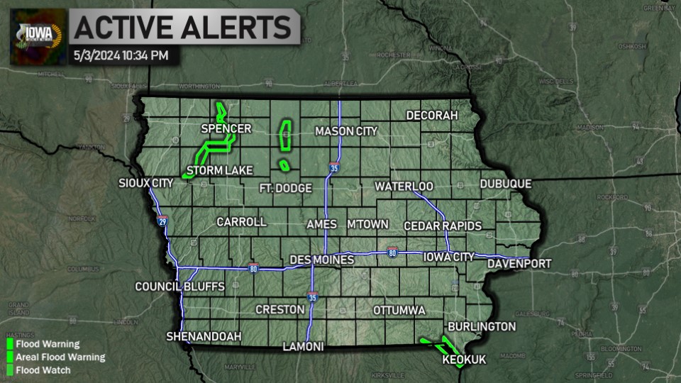
FLOOD ADVISORY
(2 counties)Harrison, Shelby
Until 10:45 PM Friday
WHAT...Flooding caused by excessive rainfall is expected. WHERE...A portion of southwest Iowa, including the following counties, Harrison and Shelby. WHEN...Until 1045 PM CDT. IMPACTS...Minor flooding in low-lying and poor drainage areas. ADDITIONAL DETAILS... - At 736 PM CDT, Doppler radar indicated heavy rain due to thunderstorms. Minor flooding is ongoing or expected to begin shortly in the advisory area. Between 1 and 2 inches of rain have fallen. - Additional rainfall amounts up to 1 inch are expected over the area. This additional rain will result in minor flooding. - Some locations that will experience flooding include... Harlan, Shelby, Earling, Irwin, Persia, Defiance, Panama, Portsmouth, Westphalia, Tennant and Kirkman. - http://www.weather.gov/safety/flood
Turn around, don't drown when encountering flooded roads. Most flood deaths occur in vehicles. Be aware of your surroundings and do not drive on flooded roads.
Until 10:45 PM Friday
More Information
Turn around, don't drown when encountering flooded roads. Most flood deaths occur in vehicles. Be aware of your surroundings and do not drive on flooded roads.